
Pond Inlet topographic map
Interactive map
Click on the map to display elevation.
About this map
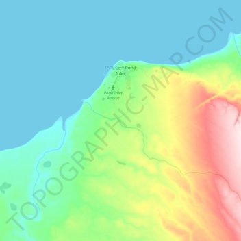
Name: Pond Inlet topographic map, elevation, terrain.
Location: Pond Inlet, Nunavut, Canada (72.62827 -78.16662 72.71666 -77.76129)
Average elevation: 82 m
Minimum elevation: 0 m
Maximum elevation: 359 m