
Sai Wan topographic map
Interactive map
Click on the map to display elevation.
About this map
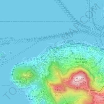
Name: Sai Wan topographic map, elevation, terrain.
Average elevation: 81 m
Minimum elevation: -2 m
Maximum elevation: 534 m
Other topographic maps
Click on a map to view its topography, its elevation and its terrain.
Pok Fu Lam Reservoir
China > Hong Kong > Hong Kong Island
Pok Fu Lam Reservoir, Telegraph Bay, Pok Fu Lam, Southern District, Hong Kong Island, Hong Kong, China
Average elevation: 192 m