
Semarapura Kelod topographic map
Interactive map
Click on the map to display elevation.
About this map
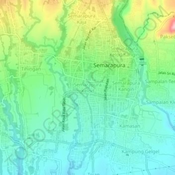
Name: Semarapura Kelod topographic map, elevation, terrain.
Location: Semarapura Kelod, Bali, Indonesia (-8.56038 115.37871 -8.52038 115.41871)
Average elevation: 80 m
Minimum elevation: 22 m
Maximum elevation: 220 m