
Salem topographic map
Interactive map
Click on the map to display elevation.
About this map
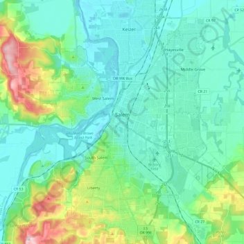
Name: Salem topographic map, elevation, terrain.
Location: Salem, Marion County, Oregon, USA (44.85125 -123.12259 45.01665 -122.93506)
Average elevation: 96 m
Minimum elevation: 30 m
Maximum elevation: 344 m