
Radeberg topographic map
Interactive map
Click on the map to display elevation.
About this map
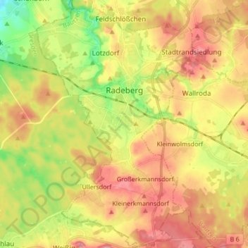
Name: Radeberg topographic map, elevation, terrain.
Location: Radeberg, Bautzen, Saxony, 01454, Germany (51.06098 13.86944 51.14586 13.95780)
Average elevation: 257 m
Minimum elevation: 200 m
Maximum elevation: 305 m