
Mühlhausen topographic map
Interactive map
Click on the map to display elevation.
About this map
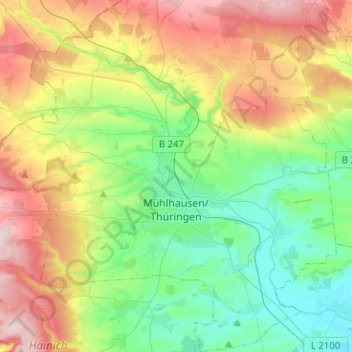
Name: Mühlhausen topographic map, elevation, terrain.
Location: Mühlhausen, Unstrut-Hainich-Kreis, Thuringia, Germany (51.14553 10.36172 51.30322 10.57395)
Average elevation: 277 m
Minimum elevation: 174 m
Maximum elevation: 472 m
Other topographic maps
Click on a map to view its topography, its elevation and its terrain.