
Waltershausen topographic map
Interactive map
Click on the map to display elevation.
About this map
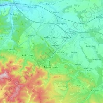
Name: Waltershausen topographic map, elevation, terrain.
Location: Waltershausen, Landkreis Gotha, Thuringia, 99880, Germany (50.84262 10.40162 50.92132 10.61872)
Average elevation: 426 m
Minimum elevation: 257 m
Maximum elevation: 916 m