
Hoheneck topographic map
Interactive map
Click on the map to display elevation.
About this map
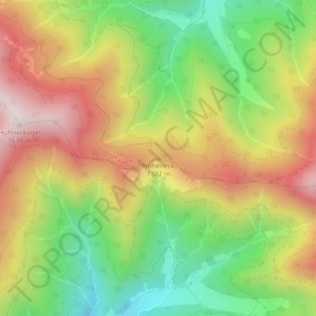
Name: Hoheneck topographic map, elevation, terrain.
Location: Hoheneck, Mautern in Steiermark, Leoben, Styria, 8774, Austria (47.44503 14.85984 47.44513 14.85994)
Average elevation: 1,270 m
Minimum elevation: 951 m
Maximum elevation: 1,615 m