
Felipe Ángeles topographic map
Interactive map
Click on the map to display elevation.
About this map
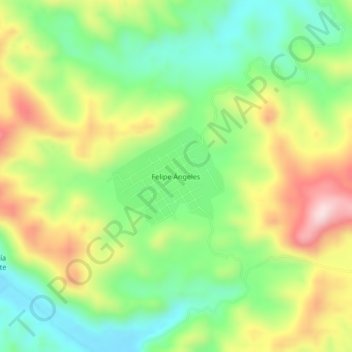
Name: Felipe Ángeles topographic map, elevation, terrain.
Location: Felipe Ángeles, Las Choapas, Veracruz, Mexico (17.29111 -93.85833 17.33111 -93.81833)
Average elevation: 247 m
Minimum elevation: 92 m
Maximum elevation: 469 m