
Lugoj topographic map
Interactive map
Click on the map to display elevation.
About this map
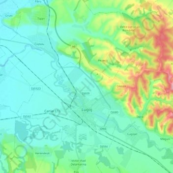
Name: Lugoj topographic map, elevation, terrain.
Location: Lugoj, Timiș, Romania (45.65025 21.82193 45.75990 22.03063)
Average elevation: 145 m
Minimum elevation: 107 m
Maximum elevation: 272 m
Other topographic maps
Click on a map to view its topography, its elevation and its terrain.