
Sungai Sitiawan topographic map
Interactive map
Click on the map to display elevation.
About this map
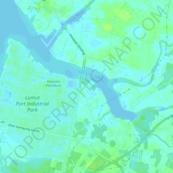
Name: Sungai Sitiawan topographic map, elevation, terrain.
Location: Sungai Sitiawan, Sitiawan, Manjung, Perak, 32000, Malaysia (4.23947 100.65954 4.26938 100.70271)
Average elevation: 4 m
Minimum elevation: -9 m
Maximum elevation: 12 m
Other topographic maps
Click on a map to view its topography, its elevation and its terrain.
Batu 8 Lekir
Malaysia > Perak > Sitiawan > Batu 8 Lekir
Batu 8 Lekir, Sitiawan, Manjung, Perak, 32020, Malaysia
Average elevation: 4 m
Batu Undan
Batu Undan, Sitiawan, Manjung, Perak, Malaysia
Average elevation: 19 m