
Meurs topographic map
Interactive map
Click on the map to display elevation.
About this map
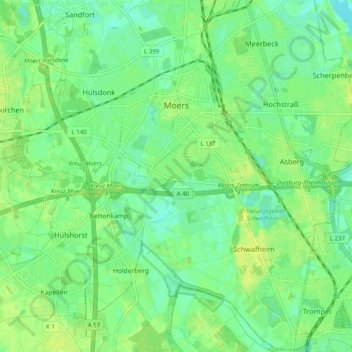
Name: Meurs topographic map, elevation, terrain.
Location: Meurs, Moers, Kreis Wesel, Noordrijn-Westfalen, Duitsland (51.40816 6.57932 51.46951 6.67874)
Average elevation: 29 m
Minimum elevation: 21 m
Maximum elevation: 37 m