
Sidney topographic map
Interactive map
Click on the map to display elevation.
About this map
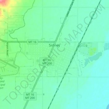
Name: Sidney topographic map, elevation, terrain.
Location: Sidney, Richland County, Montana, United States (47.69608 -104.20635 47.72959 -104.13905)
Average elevation: 593 m
Minimum elevation: 575 m
Maximum elevation: 656 m
Sidney is located in the northeastern part of the state at 47°42′45″N 104°9′41″W / 47.71250°N 104.16139°W / 47.71250; -104.16139 (47.712519, -104.161486), at an altitude of 1,949 feet (594 m).