
Thank you for supporting this site ❤️
Make a donation
Make a donation
Lotte topographic map
Click on the map to display elevation.
Thank you for supporting this site ❤️
Make a donation
Make a donation
About this map
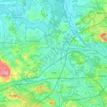
Name: Lotte topographic map, elevation, terrain.
Location: Lotte, Kreis Steinfurt, North Rhine-Westphalia, Germany (52.23251 7.88106 52.36574 7.99133)
Average elevation: 75 m
Minimum elevation: 49 m
Maximum elevation: 180 m
Thank you for supporting this site ❤️
Make a donation
Make a donation