
Wieler topographic map
Interactive map
Click on the map to display elevation.
About this map
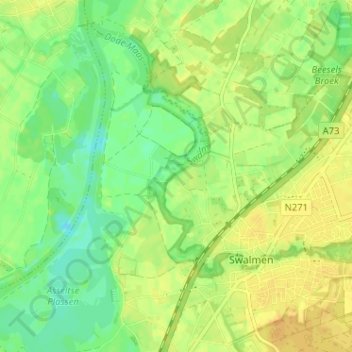
Name: Wieler topographic map, elevation, terrain.
Location: Wieler, Swalmen, Roermond, Limburg, Nederland, 6071, Nederland (51.22086 6.00199 51.26086 6.04199)
Average elevation: 22 m
Minimum elevation: 8 m
Maximum elevation: 33 m