
Rotarea topographic map
Interactive map
Click on the map to display elevation.
About this map
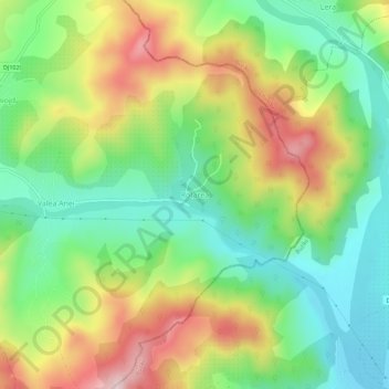
Name: Rotarea topographic map, elevation, terrain.
Location: Rotarea, Prahova, 107540, Romania (45.29294 26.19699 45.33294 26.23699)
Average elevation: 498 m
Minimum elevation: 359 m
Maximum elevation: 705 m