
Quadrath-Ichendorf topographic map
Interactive map
Click on the map to display elevation.
About this map
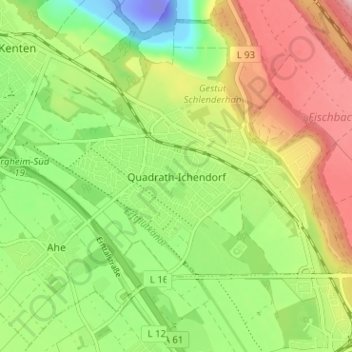
Name: Quadrath-Ichendorf topographic map, elevation, terrain.
Average elevation: 82 m
Minimum elevation: -85 m
Maximum elevation: 188 m
Other topographic maps
Click on a map to view its topography, its elevation and its terrain.
In den Benden
Deutschland > Nordrhein-Westfalen > Rhein-Erft-Kreis > Bergheim > Glesch
In den Benden, Glesch, Bergheim, Rhein-Erft-Kreis, Nordrhein-Westfalen, 50126, Deutschland
Average elevation: 68 m
Bergheim
Deutschland > Nordrhein-Westfalen > Rhein-Erft-Kreis > Bergheim
Bergheim, Rhein-Erft-Kreis, Nordrhein-Westfalen, Deutschland
Average elevation: 84 m