
De Witt topographic map
Interactive map
Click on the map to display elevation.
About this map
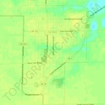
Name: De Witt topographic map, elevation, terrain.
Location: De Witt, Arkansas County, Arkansas, United States (34.26759 -91.35113 34.30389 -91.32302)
Average elevation: 58 m
Minimum elevation: 45 m
Maximum elevation: 63 m
Other topographic maps
Click on a map to view its topography, its elevation and its terrain.
DeWitt City Park
United States > Arkansas > Arkansas County > De Witt
DeWitt City Park, De Witt, Arkansas County, Arkansas, United States
Average elevation: 59 m