
Ice topographic map
Interactive map
Click on the map to display elevation.
About this map
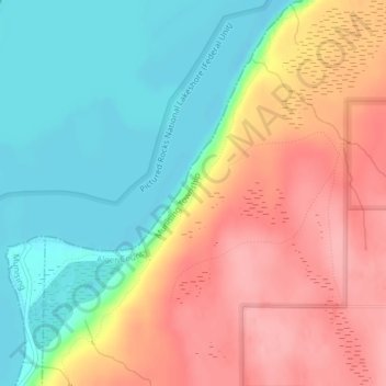
Name: Ice topographic map, elevation, terrain.
Location: Ice, Alger County, Michigan, United States (46.45668 -86.58963 46.45678 -86.58953)
Average elevation: 226 m
Minimum elevation: 174 m
Maximum elevation: 283 m
Other topographic maps
Click on a map to view its topography, its elevation and its terrain.
Kiva
United States > Michigan > Alger County
Kiva, Limestone Township, Alger County, Michigan, United States
Average elevation: 310 m
Indian Town
United States > Michigan > Alger County
Indian Town, Alger County, Michigan, United States
Average elevation: 270 m
Christmas
United States > Michigan > Alger County > Au Train Township > Christmas
Christmas, Au Train Township, Alger County, Michigan, 49862, United States
Average elevation: 203 m
Munising
United States > Michigan > Alger County > Munising
Munising, Alger County, Michigan, United States
Average elevation: 213 m