
Malvern East topographic map
Interactive map
Click on the map to display elevation.
About this map
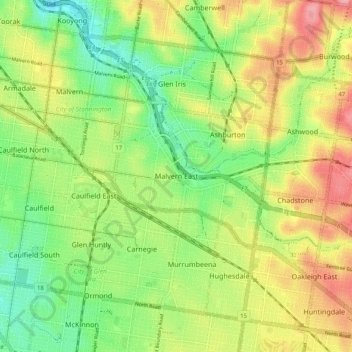
Name: Malvern East topographic map, elevation, terrain.
Average elevation: 52 m
Minimum elevation: 4 m
Maximum elevation: 111 m
Other topographic maps
Click on a map to view its topography, its elevation and its terrain.
Gardiners Creek
Australia > Victoria > Melbourne > Malvern East
Gardiners Creek, Glen Iris, Malvern East, Melbourne, City of Stonnington, Victoria, 3146, Australia
Average elevation: 37 m
Hedgeley Dene Gardens
Australia > Victoria > Melbourne > Malvern East
Hedgeley Dene Gardens, Malvern East, Melbourne, City of Stonnington, Victoria, Australia
Average elevation: 42 m
Ardrie Park
Australia > Victoria > Melbourne > Malvern East
Ardrie Park, Malvern East, Melbourne, City of Stonnington, Victoria, Australia
Average elevation: 46 m