
Águas Santas topographic map
Interactive map
Click on the map to display elevation.
About this map
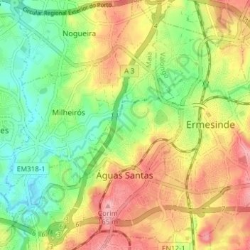
Name: Águas Santas topographic map, elevation, terrain.
Location: Águas Santas, Maia, Porto, Norte, Portugal (41.19388 -8.60249 41.24002 -8.55500)
Average elevation: 97 m
Minimum elevation: 43 m
Maximum elevation: 158 m