
Gümüşdere topographic map
Interactive map
Click on the map to display elevation.
About this map
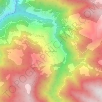
Name: Gümüşdere topographic map, elevation, terrain.
Location: Gümüşdere, Kabadüz, Ordu, Black Sea Region, Turkey (40.67913 37.85990 40.71913 37.89990)
Average elevation: 1,036 m
Minimum elevation: 345 m
Maximum elevation: 1,547 m