
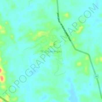
FELDA Jerangau topographic map
Interactive map
Click on the map to display elevation.
About this map
Name: FELDA Jerangau topographic map, elevation, terrain.
Location: FELDA Jerangau, Dungun, Terengganu, Malaysia (4.87846 103.17094 4.91846 103.21094)
Average elevation: 17 m
Minimum elevation: 3 m
Maximum elevation: 66 m