
Raquette Lake topographic map
Interactive map
Click on the map to display elevation.
About this map
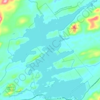
Name: Raquette Lake topographic map, elevation, terrain.
Average elevation: 559 m
Minimum elevation: 529 m
Maximum elevation: 735 m
Other topographic maps
Click on a map to view its topography, its elevation and its terrain.
Eagle Lake
United States > New York > Hamilton County > Town of Indian Lake > Eagle Nest
Average elevation: 576 m
Sagamore Lake
United States > New York > Hamilton County > Town of Long Lake > Sagamore
Average elevation: 612 m
Cedar River
United States > New York > Hamilton County > Town of Lake Pleasant
Average elevation: 763 m
Three Ponds Mountain
United States > New York > Hamilton County > Town of Benson
Average elevation: 739 m
Snowy Mountain
United States > New York > Hamilton County > Town of Indian Lake
Average elevation: 887 m
Blue Mountain Lake
United States > New York > Hamilton County > Town of Indian Lake
Average elevation: 591 m