
Delães topographic map
Interactive map
Click on the map to display elevation.
About this map
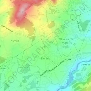
Name: Delães topographic map, elevation, terrain.
Location: Delães, Vila Nova de Famalicão, Braga, Norte, Portugal (41.37609 -8.42835 41.40174 -8.40074)
Average elevation: 148 m
Minimum elevation: 72 m
Maximum elevation: 278 m
Other topographic maps
Click on a map to view its topography, its elevation and its terrain.