
Sivry-Rance topographic map
Interactive map
Click on the map to display elevation.
About this map
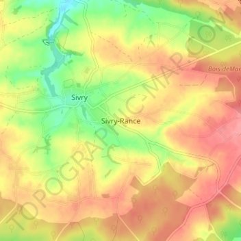
Name: Sivry-Rance topographic map, elevation, terrain.
Location: Sivry-Rance, Thuin, Henegouwen, Wallonië, 6470, België (50.14400 4.17000 50.18400 4.21000)
Average elevation: 236 m
Minimum elevation: 190 m
Maximum elevation: 269 m