
桓台县 topographic map
Interactive map
Click on the map to display elevation.
About this map
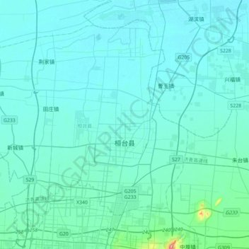
Name: 桓台县 topographic map, elevation, terrain.
Location: 桓台县, 淄博市, 山东省, 中国 (36.86154 117.83188 37.09689 118.18113)
Average elevation: 20 m
Minimum elevation: 4 m
Maximum elevation: 231 m
Other topographic maps
Click on a map to view its topography, its elevation and its terrain.
昌邑市城市规划技术服务中心潍河西开放式养殖项目
昌邑市城市规划技术服务中心潍河西开放式养殖项目, 昌邑市, 潍坊市, 山东省, 中国
Average elevation: 0 m