
Château de la Roche d'Alès topographic map
Interactive map
Click on the map to display elevation.
About this map
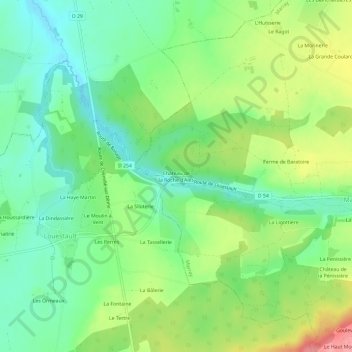
Name: Château de la Roche d'Alès topographic map, elevation, terrain.
Average elevation: 122 m
Minimum elevation: 84 m
Maximum elevation: 187 m
Other topographic maps
Click on a map to view its topography, its elevation and its terrain.
La Ligottière
France > Centre-Val de Loire > Indre-et-Loire > Marray
La Ligottière, Marray, Chinon, Indre-et-Loire, Centre-Val de Loire, France métropolitaine, 37370, France
Average elevation: 137 m
Le Haut Montas
France > Centre-Val de Loire > Indre-et-Loire > Marray
Le Haut Montas, Marray, Chinon, Indre-et-Loire, Centre-Val de Loire, France métropolitaine, 37370, France
Average elevation: 145 m