
Bruce topographic map
Interactive map
Click on the map to display elevation.
About this map
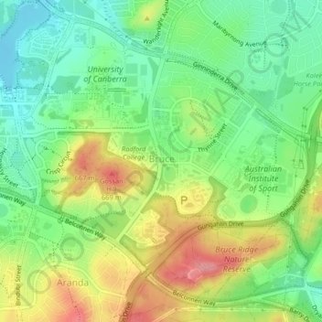
Name: Bruce topographic map, elevation, terrain.
Average elevation: 619 m
Minimum elevation: 576 m
Maximum elevation: 681 m
Other topographic maps
Click on a map to view its topography, its elevation and its terrain.
Mount Rogers
Australia > District of Belconnen
Mount Rogers is a large hill, with an elevation of 704 metres (2,310 ft), located in the northern suburbs of Canberra, within the Australian Capital Territory, Australia. There is a park called the Mount Rogers Reserve at the crest of the hill, and a trig point at the summit.
Average elevation: 620 m