
Batang Kemena topographic map
Interactive map
Click on the map to display elevation.
About this map
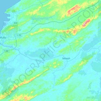
Name: Batang Kemena topographic map, elevation, terrain.
Location: Batang Kemena, Bintulu, Sarawak, 97000, Malaysia (3.10675 113.03263 3.17965 113.37106)
Average elevation: 39 m
Minimum elevation: -1 m
Maximum elevation: 339 m
Other topographic maps
Click on a map to view its topography, its elevation and its terrain.
Kampung Sungai Sebuan Besar
Malaysia > Sarawak > Bintulu > Kampung Sungai Sebuan Besar
Kampung Sungai Sebuan Besar, Bintulu, Sarawak, 97000, Malaysia
Average elevation: 12 m