
Queens County topographic map
Interactive map
Click on the map to display elevation.
About this map
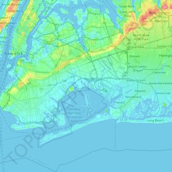
Name: Queens County topographic map, elevation, terrain.
Location: Queens County, New York, USA (40.49321 -74.04442 40.81195 -73.70018)
Average elevation: 11 m
Minimum elevation: -10 m
Maximum elevation: 111 m
Other topographic maps
Click on a map to view its topography, its elevation and its terrain.
Roosevelt Island
Roosevelt Island, Manhattan Community Board 8, New York County, New York, 10044, USA
Average elevation: 13 m