
Lago Lácar topographic map
Interactive map
Click on the map to display elevation.
About this map
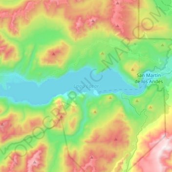
Name: Lago Lácar topographic map, elevation, terrain.
Average elevation: 1,163 m
Minimum elevation: 631 m
Maximum elevation: 2,128 m
Other topographic maps
Click on a map to view its topography, its elevation and its terrain.
Quila Quina
Argentina > Neuquén > Quila Quina
Quila Quina, Departamento Lácar, Neuquén, Argentina
Average elevation: 766 m