
Pokhara topographic map
Interactive map
Click on the map to display elevation.
Pokhara
Pokhara (Nepali: पोखरा, Nepali pronunciation: ) is a metropolitan city in Nepal, which serves as the capital of Gandaki Province. It is the country's largest metropolitan city in terms of area and second-largest in terms of population. The city also serves as the headquarters of Kaski District. Pokhara is located 200 kilometres (120 miles) west of the capital, Kathmandu. The city is on the shore of Phewa Lake, and sits at an elevation of approximately 822m. The Annapurna Range, with three out of the ten highest peaks in the world—Dhaulagiri, Annapurna I and Manaslu—is within 15–35 mi (24–56 km) of the valley.
About this map
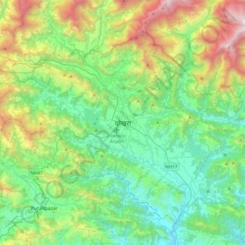
Name: Pokhara topographic map, elevation, terrain.
Location: Pokhara, Kaski, Gandaki Pradesh, 3, Nepal (28.04954 83.83140 28.36954 84.15140)
Average elevation: 1,222 m
Minimum elevation: 483 m
Maximum elevation: 3,223 m