
Hudson Bay No. 394 topographic map
Interactive map
Click on the map to display elevation.
About this map
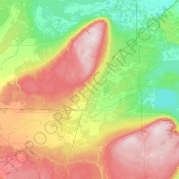
Name: Hudson Bay No. 394 topographic map, elevation, terrain.
Location: Hudson Bay No. 394, Saskatchewan, Canada (52.31791 -103.15733 53.71414 -101.63767)
Average elevation: 433 m
Minimum elevation: 257 m
Maximum elevation: 825 m