
Luweero topographic map
Interactive map
Click on the map to display elevation.
About this map
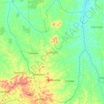
Name: Luweero topographic map, elevation, terrain.
Location: Luweero, Central Region, Uganda (0.55038 32.31885 1.14651 32.79515)
Average elevation: 1,098 m
Minimum elevation: 1,037 m
Maximum elevation: 1,334 m
Other topographic maps
Click on a map to view its topography, its elevation and its terrain.