
Menderes Mahallesi topographic map
Interactive map
Click on the map to display elevation.
About this map
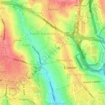
Name: Menderes Mahallesi topographic map, elevation, terrain.
Location: Menderes Mahallesi, Esenler, Istanbul, Marmara Region, Turkey (41.03758 28.87135 41.04540 28.88249)
Average elevation: 78 m
Minimum elevation: 31 m
Maximum elevation: 118 m