
Amasra topographic map
Interactive map
Click on the map to display elevation.
Amasra
In the late 8th century its bishop obtained from the Byzantine Emperor its elevation to the rank of autocephalous archeparchy. It is listed as such in the Notitia Episcopatuum attributed to Basil the Armenian (c. 840) and in that of Leo VI the Wise (early 10th century).
About this map
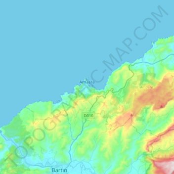
Name: Amasra topographic map, elevation, terrain.
Location: Amasra, Bartın, Black Sea Region, 74300, Turkey (41.67296 32.27947 41.81156 32.58300)
Average elevation: 121 m
Minimum elevation: 0 m
Maximum elevation: 934 m