
East Kalimantan topographic map
Interactive map
Click on the map to display elevation.
About this map
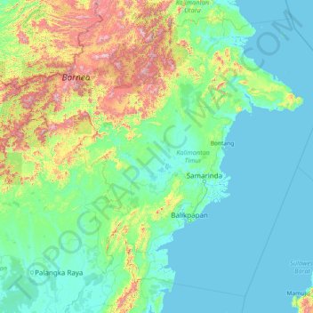
Name: East Kalimantan topographic map, elevation, terrain.
Location: East Kalimantan, Indonesia (-2.65372 113.83593 2.56902 119.66809)
Average elevation: 218 m
Minimum elevation: -4 m
Maximum elevation: 2,103 m
Other topographic maps
Click on a map to view its topography, its elevation and its terrain.
Prapatan
Indonesia > East Kalimantan > Prapatan
Prapatan, East Kalimantan, 76112, Indonesia
Average elevation: 15 m