
Eganville topographic map
Interactive map
Click on the map to display elevation.
About this map
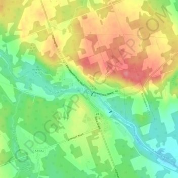
Name: Eganville topographic map, elevation, terrain.
Average elevation: 186 m
Minimum elevation: 145 m
Maximum elevation: 231 m
Other topographic maps
Click on a map to view its topography, its elevation and its terrain.
Foymount
Canada > Ontario > Renfrew County > Bonnechere Valley
Foymount, Bonnechere Valley, Renfrew County, Eastern Ontario, Ontario, Canada
Average elevation: 432 m
Lake Clear
Canada > Ontario > Renfrew County > Bonnechere Valley
Lake Clear, Bonnechere Valley, Renfrew County, Eastern Ontario, Ontario, Canada
Average elevation: 291 m
Roche Lake
Canada > Ontario > Renfrew County > Bonnechere Valley
Roche Lake, Bonnechere Valley, Renfrew County, Eastern Ontario, Ontario, Canada
Average elevation: 257 m