
Aşağı Köselerli topographic map
Interactive map
Click on the map to display elevation.
About this map
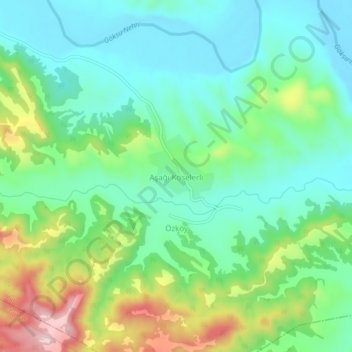
Name: Aşağı Köselerli topographic map, elevation, terrain.
Location: Aşağı Köselerli, Mut, Mersin, Mediterranean Region, Turkey (36.47428 33.48584 36.51428 33.52584)
Average elevation: 165 m
Minimum elevation: 85 m
Maximum elevation: 349 m