
Middle Sackville topographic map
Interactive map
Click on the map to display elevation.
About this map
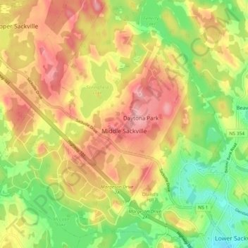
Name: Middle Sackville topographic map, elevation, terrain.
Location: Middle Sackville, Nouvelle-Écosse, Canada (44.77086 -63.77600 44.83546 -63.69237)
Average elevation: 103 m
Minimum elevation: 39 m
Maximum elevation: 161 m
Other topographic maps
Click on a map to view its topography, its elevation and its terrain.
Springfield Lake
Canada > Nouvelle-Écosse > Middle Sackville
Springfield Lake, Middle Sackville, Halifax Regional Municipality, Halifax County, Nouvelle-Écosse, Canada
Average elevation: 121 m