
Benteng topographic map
Interactive map
Click on the map to display elevation.
About this map
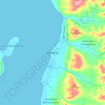
Name: Benteng topographic map, elevation, terrain.
Location: Benteng, Kecamatan Benteng, South Sulawesi, 92812, Indonesia (-6.15818 120.41813 -6.07818 120.49813)
Average elevation: 31 m
Minimum elevation: -1 m
Maximum elevation: 181 m