
Uzungöl topographic map
Interactive map
Click on the map to display elevation.
About this map
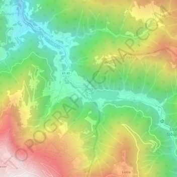
Name: Uzungöl topographic map, elevation, terrain.
Location: Uzungöl, Çaykara, Trabzon, Black Sea Region, 61960, Turkey (40.60056 40.27481 40.64056 40.31481)
Average elevation: 1,487 m
Minimum elevation: 880 m
Maximum elevation: 2,333 m