
Forstberg topographic map
Interactive map
Click on the map to display elevation.
About this map
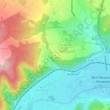
Name: Forstberg topographic map, elevation, terrain.
Average elevation: 173 m
Minimum elevation: 95 m
Maximum elevation: 305 m
Other topographic maps
Click on a map to view its topography, its elevation and its terrain.
Heimersheim
Deutschland > Rheinland-Pfalz > Bad Neuenahr-Ahrweiler > Heimersheim
Heimersheim, Bad Neuenahr-Ahrweiler, Landkreis Ahrweiler, Rheinland-Pfalz, Deutschland
Average elevation: 206 m
Heppingen
Deutschland > Rheinland-Pfalz > Bad Neuenahr-Ahrweiler > Heppingen
Heppingen, Bad Neuenahr-Ahrweiler, Landkreis Ahrweiler, Rheinland-Pfalz, Deutschland
Average elevation: 131 m