
大明湖大明湖 topographic map
Interactive map
Click on the map to display elevation.
About this map
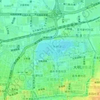
Name: 大明湖大明湖 topographic map, elevation, terrain.
Location: 大明湖大明湖, 泉城路街道, 历下区, 济南市, 山东省, 250000, 中国 (36.67200 117.01109 36.67714 117.02660)
Average elevation: 32 m
Minimum elevation: 21 m
Maximum elevation: 50 m
Other topographic maps
Click on a map to view its topography, its elevation and its terrain.