
Unorganized West Manitoulin topographic map
Interactive map
Click on the map to display elevation.
About this map
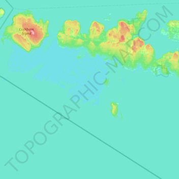
Name: Unorganized West Manitoulin topographic map, elevation, terrain.
Average elevation: 180 m
Minimum elevation: 170 m
Maximum elevation: 297 m
Other topographic maps
Click on a map to view its topography, its elevation and its terrain.
Battery Bluff Anchorage
Canada > Ontario > Unorganized West Manitoulin
Battery Bluff Anchorage, Unorganized West Manitoulin, Manitoulin District, Northeastern Ontario, Ontario, Canada
Average elevation: 195 m