
庫爾恰托夫 topographic map
Interactive map
Click on the map to display elevation.
About this map
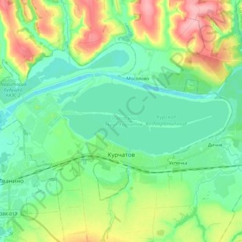
Name: 庫爾恰托夫 topographic map, elevation, terrain.
Location: 庫爾恰托夫, Курская область, Центральный федеральный округ, 俄罗斯/俄羅斯 (51.63839 35.56108 51.71157 35.74190)
Average elevation: 171 m
Minimum elevation: 139 m
Maximum elevation: 244 m