
Gölhisar topographic map
Interactive map
Click on the map to display elevation.
About this map
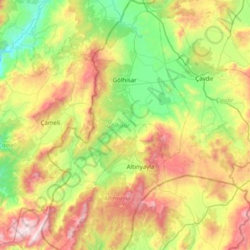
Name: Gölhisar topographic map, elevation, terrain.
Location: Gölhisar, Burdur, Mediterranean Region, Türkiye (36.84625 29.32559 37.29313 29.65679)
Average elevation: 1,340 m
Minimum elevation: 758 m
Maximum elevation: 2,410 m