
Bartın topographic map
Interactive map
Click on the map to display elevation.
About this map
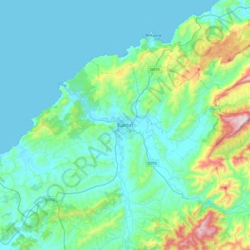
Name: Bartın topographic map, elevation, terrain.
Location: Bartın, Bartın merkez, Bartın, Black Sea Region, 74100, Turkey (41.47384 32.17844 41.79384 32.49844)
Average elevation: 155 m
Minimum elevation: 0 m
Maximum elevation: 948 m
Other topographic maps
Click on a map to view its topography, its elevation and its terrain.