
Embalse Potrerillos topographic map
Interactive map
Click on the map to display elevation.
About this map
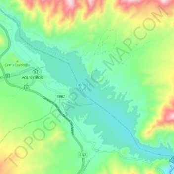
Name: Embalse Potrerillos topographic map, elevation, terrain.
Average elevation: 1,502 m
Minimum elevation: 1,267 m
Maximum elevation: 2,050 m
Other topographic maps
Click on a map to view its topography, its elevation and its terrain.
Punta de Vacas
Argentina > Mendoza > Distrito Potrerillos > Punta de Vacas
Punta de Vacas, Distrito Potrerillos, Departamento Luján de Cuyo, Mendoza, Argentina
Average elevation: 2,768 m